Archivo digital de mapas de orientación de Ivan Sirakov
|
Acceso
Todos los usuarios
|
Language:
Español
Česky
Dansk
Deutsch
Eesti
English
Español
Français
Italiano
Magyar
lietuvių kalba
Norsk
Polski
Português
Русский
Svenska
Türkçe
Український
|
DOMA 3.0.10
Show overview map
Hide overview map
|
KML
|
Atrás
<< Easy jogging (2011-04-06)
|
Easy, in pairs (2011-04-07) >>
HSK-TIO Test, night (2011-04-06)
Categoría:
Trainings
Mapa/área:
Hauglund, Halden
País:
Norway
Distance:
8.5 km
Time:
75:45
Average HR:
161
Maximum HR:
179
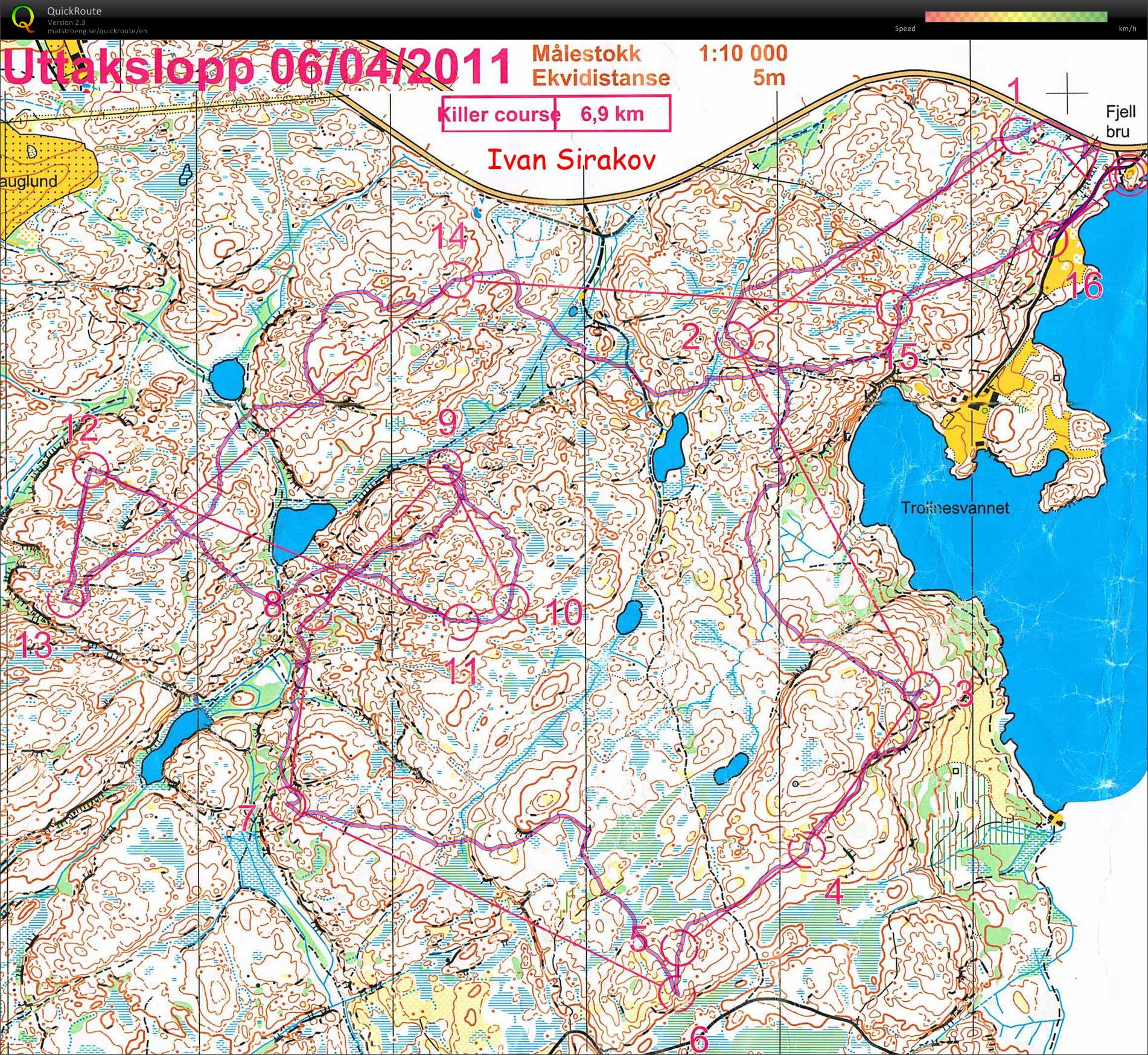
Mistakes on the way to 7th (30'' - lost direction), 12th (1' - not taking the path being secure), 14th (2' - lost direction), 15th (3' - wanted to go more straight, lost control). Missed the last one as well (1'30'').
Show comments
Hide comments
(
0
)
Post new comment
Nombre:
Email:
Guardar
 Español
 Česky
 Dansk
 Deutsch
 Eesti
 English
 Français
 Italiano
 Magyar
 lietuvių kalba
 Norsk
 Polski
 Português
 Русский
 Svenska
 Türkçe
 Український